Mostrar el registro sencillo del ítem
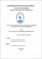
Efecto de la confluencia del río Chicama con el tributario San Felipe en el puente José Gildemeister
| dc.contributor.advisor | Cabanillas Quiroz, Guillermo Juan | |
| dc.contributor.author | Cenas Pereda, Anthony Gabriel | |
| dc.contributor.author | Montoya Ramos, Kevin Jhonatan | |
| dc.creator | Cenas Pereda, Anthony Gabriel | |
| dc.date.accessioned | 2019-05-06T22:09:34Z | |
| dc.date.available | 2019-05-06T22:09:34Z | |
| dc.date.issued | 2019 | |
| dc.identifier.uri | https://hdl.handle.net/20.500.12759/4770 | |
| dc.description.abstract | La presente investigación tiene como objetivo elaborar el análisis hidráulico en la confluencia del rio Chicama con el tributario San Felipe en el tramo de puente Bailey José Gildemeister, para poder evaluar escenarios futuros y poder mitigar daños posibles provocados por la crecida del rio Chicama y la quebrada de San Felipe, las cuales afectan directamente al distrito de Marmot, provincia Gran Chimú- La libertad, teniendo en cuenta la evaluación dicha confluencia en el tramo puente José Gildemeister, se ha desarrollado un estudio hidráulico de los ríos mencionados, que nos permite realizar el estudio hidrológico que consiste en estimar descargas máximas a partir de reporte de caudales máximos en 24 horas registradas en la estación El tambo, para el cálculo de caudal del rio Chicama en periodos de retorno 50,100 y 500 años a través de un análisis con métodos estadísticos con ayuda del programa Hydrognomon, así como también el cálculo aproximado del caudal del tributario San Felipe para periodos de retorno de 2,5,10,20,50,100 y 50 años a través de un análisis con métodos empíricos , posteriormente se elaboró un levantamiento topográfico mediante dron de la zona en estudio, para poder evaluar por medio de un modelamiento hidráulico con el software IBER los niveles de aguas máximas a lo largo de la confluencia así como también la acción erosiva del agua en el estudio objetivo de la socavación, para lo cual se extrajeron calicatas y mediante el método de Lischtvan - Levediev y K. F. Artamonov para el cálculo de socavación general y local respectivamente se determinó la altura de socavaciones, se procedió a evaluar las simulaciones con los diferentes periodos de retorno, de esta manera poder identificar posibles zonas inundadas, con el único fin de proveer daños futuros por el incremento de aguas del rio Chicama y el tributario San Felipe. | es_PE |
| dc.description.abstract | The objective of this research is to develop the hydraulic analysis at the confluence of the Chicama River with the San Felipe tributary on the Bailey José Gildemeister bridge section, in order to evaluate future scenarios and mitigate possible damages caused by the rising of the Chicama River and the gorge of San Felipe, which directly affect the district of Marmot, province of Gran Chimú- La Libertad, taking into account the evaluation of the confluence in the José Gildemeister bridge section, a hydraulic study of the mentioned rivers has been developed, which allows us to carry out the hydrological study that consists of estimating maximum discharges from the report of maximum flows in 24 hours recorded in the El Tambo station, for the calculation of the flow of the Chicama River in return periods 50,100 and 500 years through an analysis with statistical methods with of the Hydrognomon program, as well as the approximate calculation of the flow rate of the Tax San Felipe for periods of return of 2,5,10,20,50,100 and 50 years through an analysis with empirical methods, later a topographic survey by drone of the study area was elaborated, to be able to evaluate by means of a hydraulic modeling with the IBER software the maximum water levels along the confluence as well as the erosive action of the water in the objective study of the undermining, for which pits were extracted and by means of the method of Lischtvan - Levediev and KF Artamonov for the calculation of general and local scour, respectively, the height of scour holes was determined, the simulations were evaluated with the different return periods, in this way to identify possible flooded areas, with the sole purpose of providing future damages due to the increase in waters of the Chicama River and the San Felipe tributary | en_US |
| dc.description.uri | Tesis | es_PE |
| dc.format | application/pdf | es_PE |
| dc.language.iso | spa | es_PE |
| dc.publisher | Universidad Privada Antenor Orrego | es_PE |
| dc.relation.ispartofseries | T_ING.CIVIL_1708 | |
| dc.rights | info:eu-repo/semantics/closedAccess | es_PE |
| dc.rights.uri | https://creativecommons.org/licenses/by/4.0/ | es_PE |
| dc.source | Universidad Privada Antenor Orrego | es_PE |
| dc.source | Repositorio Institucional - UPAO | es_PE |
| dc.subject | Análisis hidráulico | es_PE |
| dc.subject | Río Chicama | es_PE |
| dc.subject | Estudio hidrológico | es_PE |
| dc.title | Efecto de la confluencia del río Chicama con el tributario San Felipe en el puente José Gildemeister | es_PE |
| dc.type | info:eu-repo/semantics/bachelorThesis | es_PE |
| thesis.degree.level | Título Profesional | es_PE |
| thesis.degree.grantor | Universidad Privada Antenor Orrego. Facultad de Ingeniería | es_PE |
| thesis.degree.name | Ingeniero Civil | es_PE |
| thesis.degree.discipline | Ingeniería Civil | es_PE |
| dc.subject.ocde | https://purl.org/pe-repo/ocde/ford#2.01.00 | |
| renati.type | https://purl.org/pe-repo/renati/type#tesis | |
| renati.level | https://purl.org/pe-repo/renati/level#tituloProfesional | |
| dc.publisher.country | PE | es_PE |
Ficheros en el ítem
Este ítem aparece en la(s) siguiente(s) colección(es)
-
Ingeniería Civil [1260]


